Offline routing
Add waypoints and the route snaps to the trails around you, with or without a signal.
 Peak Explorer
Hiking & MTB trails in Europe
Peak Explorer is the trail map for people who hike and bike in the mountains. Download your country once and the map works even where there's no signal: topo map, trails, mountain huts, contour lines and elevations all stay on your phone.
For iPhone (iOS 26 or later) and Apple Watch, on the App Store.
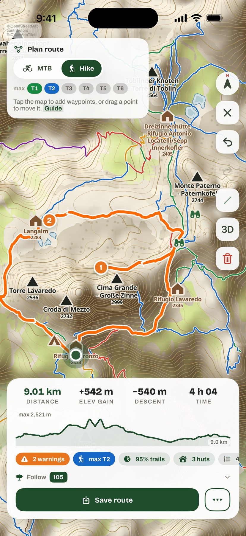
Plan your route
Routes are worked out on your phone from the trails in your offline map, so planning works even with no connection.
Add waypoints and the route snaps to the trails around you, with or without a signal.
Pick hiking or mountain biking and the maximum difficulty you want to ride or walk.
Distance, elevation gain, estimated duration and arrival time, with steep sections flagged.
Only have a starting point? Get loops of 2 hours, 4 hours or a full day. Save them and share them as GPX.
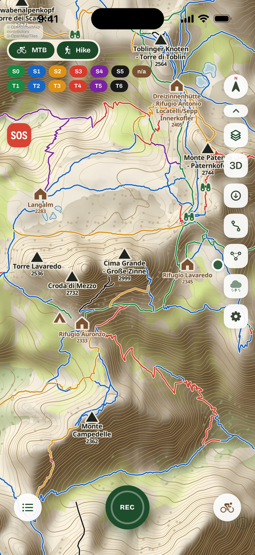
Trails colored by difficulty
Every trail takes the color of its grade, so you can tell at a glance what you're heading into. Filters hide whatever isn't for you.
SAC hiking scale T1T2T3T4T5T6
Singletrail MTB scale S0S1S2S3S4S5
Mountain huts, bivouac shelters, springs, waterfalls, caves, campgrounds and viewpoints, visible even when you're zoomed out over the whole valley.
Trails and grades come from OpenStreetMap and the community that keeps it up to date. Spot a mistake? You can fix it at the source.
Offline maps by country
Download it whenever you like from Offline Areas: topo map, trails, points of interest, contour lines and a terrain model. More countries are added over time, at no extra cost.
With a connection you can also use Apple Maps in Standard, Hybrid or Satellite view, always with the trails on top.
One tap and the terrain rises up: ridges, valleys and slopes at their true elevations, drawn right on your phone with no connection.
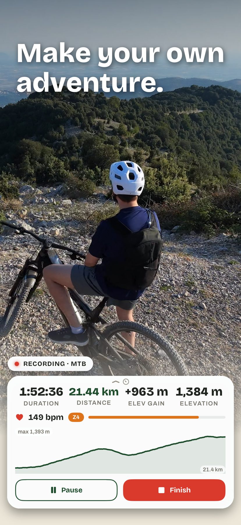
Record your hike or ride
Distance, time, elevation, elevation gain and speed. Gain is measured with the barometer and filtered for noise, not inflated.
Review each track on its elevation profile, find it in your log with its stats, and export it as GPX.
Start from your wrist, see your heart rate and effort zone, and the workout ends up in Health.
Hikes and routes are also saved to your own iCloud: Save to iCloud is on by default and you can turn it off in Settings. Heart rate, calories and cadence are never copied there by the app: they stay on your iPhone and in Health.
Also on the map
Import a route from anyone, see it in orange on the map and follow it step by step, in 3D too.
Precipitation radar with the last hour animated, lightning shown with its own symbol, and hour-by-hour forecasts for where you are or any spot you tap. From public European and North American sources. The weather layer stays off until you switch it on.
Your coordinates in large type, with elevation and accuracy, ready to read out or share in a message. The coordinates are shown even with no signal, and this screen stays free, with or without a purchase.
The app speaks your phone's language, and you can change it anytime in Settings: 37 languages, including regional variants.
Your data stays yours
No account, no profile, no e-mail address to hand over. Open the app and go.
Maps, hikes, routes and contacts live on your iPhone and, if you keep Save to iCloud on, in your own iCloud. There is no Peak Explorer server that collects them.
The app never copies heart rate, calories or cadence to iCloud, and never uses them for advertising. The details are in the Privacy Policy.
What it costs
No subscription and nothing to renew.
The trial starts when you tap Start Free Trial on the welcome screen. No card, no account, nothing to cancel: it simply ends.
Unlock everything, including the countries added later, with a single in-app purchase. The price is shown on the App Store in your currency and set by country. Restore it at no charge on devices signed in to the same Apple Account.
The Emergency Location screen, with your coordinates, stays available after the trial even if you don't buy.
After the trial, without a purchase, maps (including downloaded ones), trails, the planner, recording and weather are locked. Your downloads stay on your phone and come back as soon as you unlock; your hikes and routes stay available from the purchase page, where you can open, export or delete them. Family Sharing is not available for this purchase. Payment, refunds and billing are handled by Apple; see the Additional Terms.
Peak Explorer is not a safety device. In the mountains, always carry a paper map, a compass and good judgment.
Map data © OpenStreetMap contributors (ODbL). All data sources and licenses are listed on the Licenses page.